Checked
Waterloo parks directory
Waterloo, Ontario, Canada
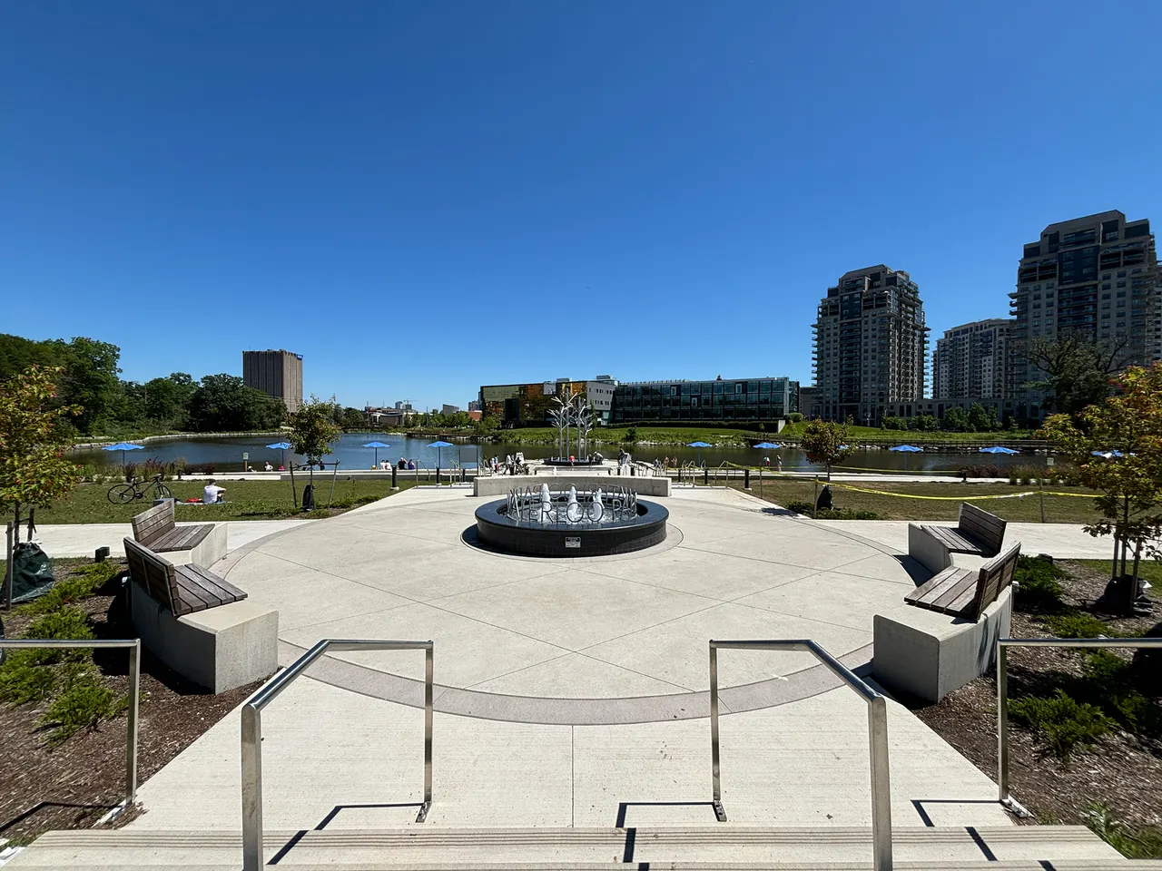
Find Waterloo, Ontario parks and open spaces, with individual descriptions, recorded facilities, photos where verified and Google Maps.
Key information
Browse 210 park and open-space sections for Waterloo. Search a name, street or recorded feature, then open that place’s map. The source scope and any missing information are explained below.
On this page
What this directory covers
| Detail | Coverage |
|---|---|
| Individual sections | 210 |
| Source scope | All records classified as Neighbourhood Parks, Community Parks, Major Park, Culturally Significant Parks, Linear Parks and Links, or Special Agreement Parkland in the 310-record official park-land inventory. Environmental land, ponds and operational land are preserved as exclusions, not presented as visitor parks. |
| Coverage limits | All entries in the stated source scope are included. This does not establish current public access. |
All records classified as Neighbourhood Parks, Community Parks, Major Park, Culturally Significant Parks, Linear Parks and Links, or Special Agreement Parkland in the 310-record official park-land inventory. Environmental land, ponds and operational land are preserved as exclusions, not presented as visitor parks.
Recorded facilities can be seasonal, closed or out of service. A blank field means not confirmed. A map point may mark park land rather than a public or accessible entrance.
Sources: Waterloo official GIS park inventory · Waterloo city parks bylaw
Find a park
Search the recorded names, streets, descriptions and facilities. Each result has its own section and map links. Only the places on the current page are downloaded.
Some pins mark park land rather than an entrance. Official park pages have current visiting details.
81 to 100 of 210 places
Goldthread Park
606 GOLDTHREAD ST
Goldthread Park has playground listed in the city inventory. The recorded address is 606 GOLDTHREAD ST.
- Source type
- Neighbourhood Parks
- Listed facilities
- playground
- Recorded area
- 0.07 hectares
Sources: Waterloo official GIS park record
Grand Banks Link
775 GRAND BANKS DR
Grand Banks Link is recorded as linear parks and links in the city park inventory. Its recorded location is 775 GRAND BANKS DR.
- Source type
- Linear Parks and Links
- Recorded area
- 0.14 hectares
Sources: Waterloo official GIS park record
Gray Dogwood Park
347 RED OSIER RD
Gray Dogwood Park is recorded as neighbourhood parks in the city park inventory. Its recorded location is 347 RED OSIER RD.
- Source type
- Neighbourhood Parks
- Recorded area
- 0.05 hectares
Sources: Waterloo official GIS park record
Grey Alder Walkway
NA
Grey Alder Walkway is recorded as linear parks and links in the city park inventory. Its recorded location is NA.
- Source type
- Linear Parks and Links
- Recorded area
- 0.02 hectares
Sources: Waterloo official GIS park record
Grey Silo Golf Course
2001 UNIVERSITY AVE E
Grey Silo Golf Course is recorded as special agreement parkland in the city park inventory. Its recorded location is 2001 UNIVERSITY AVE E.
- Source type
- Special Agreement Parkland
- Recorded area
- 63.60 hectares
Sources: Waterloo official GIS park record
Grey Silo Park
290 GREY SILO RD
Grey Silo Park has playground, seasonal rink listed in the city inventory. The recorded address is 290 GREY SILO RD.
- Source type
- Neighbourhood Parks
- Listed facilities
- playground, seasonal rink
- Recorded area
- 0.50 hectares
Sources: Waterloo official GIS park record
Haida Park
631 BREAKWATER CRES
Haida Park has playground, seasonal rink listed in the city inventory. The recorded address is 631 BREAKWATER CRES.
- Source type
- Neighbourhood Parks
- Listed facilities
- playground, seasonal rink
- Recorded area
- 0.57 hectares
Sources: Waterloo official GIS park record
Heasley Park
455 PARKSIDE DR
Heasley Park has playground, tennis courts listed in the city inventory. The recorded address is 455 PARKSIDE DR.
- Source type
- Neighbourhood Parks
- Listed facilities
- playground, tennis courts
- Recorded area
- 3.12 hectares
Sources: Waterloo official GIS park record
Heather Hill Link
518 HEATHER HILL PL
Heather Hill Link is recorded as linear parks and links in the city park inventory. Its recorded location is 518 HEATHER HILL PL.
- Source type
- Linear Parks and Links
- Recorded area
- 0.45 hectares
Sources: Waterloo official GIS park record
Heritage Green
148 KING ST S
Heritage Green is recorded as culturally significant parks in the city park inventory. Its recorded location is 148 KING ST S.
- Source type
- Culturally Significant Parks
- Recorded area
- 0.13 hectares
Sources: Waterloo official GIS park record
Hillside Park Facility
352 MARSLAND DR
Hillside Park Facility has ball diamonds, washroom listed in the city inventory. The recorded address is 352 MARSLAND DR.
- Source type
- Community Parks
- Listed facilities
- ball diamonds, washroom
- Recorded area
- 2.90 hectares
Sources: Waterloo official GIS park record
Holbeach Green
120 LEXINGTON RD
Holbeach Green is recorded as neighbourhood parks in the city park inventory. Its recorded location is 120 LEXINGTON RD.
- Source type
- Neighbourhood Parks
- Recorded area
- 0.21 hectares
Sources: Waterloo official GIS park record
Hollyview Park
530 LAURELWOOD DR
Hollyview Park is recorded as neighbourhood parks in the city park inventory. Its recorded location is 530 LAURELWOOD DR.
- Source type
- Neighbourhood Parks
- Recorded area
- 0.18 hectares
Sources: Waterloo official GIS park record
Hydro Trail
CHANCERY LANE
Hydro Trail is recorded as special agreement parkland in the city park inventory. Its recorded location is CHANCERY LANE.
- Source type
- Special Agreement Parkland
- Recorded area
- 0.08 hectares
Sources: Waterloo official GIS park record
Interlaken Park
662 INTERLAKEN DR
Interlaken Park has playground listed in the city inventory. The recorded address is 662 INTERLAKEN DR.
- Source type
- Neighbourhood Parks
- Listed facilities
- playground
- Recorded area
- 0.21 hectares
Sources: Waterloo official GIS park record
Iron Horse Trail
KING ST
Iron Horse Trail is recorded as linear parks and links in the city park inventory. Its recorded location is KING ST.
- Source type
- Linear Parks and Links
- Recorded area
- 0.19 hectares
Sources: Waterloo official GIS park record
Jacob Green
675 JACOB LANE
Jacob Green has playground listed in the city inventory. The recorded address is 675 JACOB LANE.
- Source type
- Neighbourhood Parks
- Listed facilities
- playground
- Recorded area
- 0.05 hectares
Sources: Waterloo official GIS park record
John & Allen St
0 Allen St
John & Allen St is recorded as special agreement parkland in the city park inventory. Its recorded location is 0 Allen St.
- Source type
- Special Agreement Parkland
Sources: Waterloo official GIS park record
Karen Walk Parkette
316 KAREN PL
Karen Walk Parkette is recorded as neighbourhood parks in the city park inventory. Its recorded location is 316 KAREN PL.
- Source type
- Neighbourhood Parks
- Recorded area
- 0.55 hectares
Sources: Waterloo official GIS park record
Kaufman Flats
755 UNIVERSITY AVE E
Kaufman Flats is recorded as special agreement parkland in the city park inventory. Its recorded location is 755 UNIVERSITY AVE E.
- Source type
- Special Agreement Parkland
- Recorded area
- 7.73 hectares
Sources: Waterloo official GIS park record
Planning your park visit
How many Waterloo park sections are in this directory?
210 named places are included. They come from the official source scope explained above. Land records do not confirm that every area is open today.
Where can I find a Waterloo park near me?
Use the alphabetical park list and its map links. Compare the recorded address and facilities before travelling. Land-centre map points should not be used as entrance directions.
Which Waterloo parks have playgrounds?
Alexandra Park, Angler Way Park, Atlantic Park, Auburn Park, Autumn Willow Park, Avens Park, Basswood Park, Bechtel Park Facility. The individual sections identify all playgrounds explicitly recorded by these sources.
Does a blank facilities field mean there is no playground or washroom?
No. A blank field means the source does not list that detail. It is not proof that the facility is absent.
Are these maps accessible entrance directions?
No. GIS records can mark park land or a site point. The note under each place explains the map limit. A park point does not verify slopes, surfaces, steps or an accessible entrance.
How do I check facilities at a Waterloo park?
Read the listed facilities in its section, then open the city record for current details. The list reflects source records, not a live inspection of equipment.
Can I assume a listed washroom is open all year?
No. The inventory records a facility, not its daily or seasonal opening status. Check the city park page before a trip that depends on a washroom.
Why do some park names appear more than once?
A municipal inventory can hold separate land parcels or service locations for one park. Matching parcels are grouped and their original record IDs are retained. Different recorded locations remain visible.
Can I visit Waterloo parks late at night?
The general bylaw closes parks from 11 p.m. to 6 a.m. There are listed exceptions, including Waterloo Park Laurel Trail, which permits entry 24 hours. The director can close a park at any time.
Source: Waterloo city parks bylaw
Does this directory include every conservation area and private park?
No. It covers the stated municipal park sources. Provincial parks, conservation authority land and private sites need separate operator records. The evidence ledger keeps excluded records and missing information.
Official park information
Sources: Waterloo official GIS park inventory · Waterloo city parks bylaw